Dr Martin Woods, Curator of Maps, National Library of Australia
The National Library of Australia is fortunate to have an extensive collection of printed and manuscript material, cartography, correspondence, drawings and other works produced as a result or in the course of many of the French Asia-Pacific voyages of the late eighteenth and early nineteenth centuries. The maps, atlases, documents and pictures on display in the Maps Room for the Freycinet Symposium are contemporary accounts and artefacts accumulated over many years by the Library. All are stored under controlled conditions, and only occasionally placed on display. The Symposium provided one such opportunity, and to showcase one or two very recent acquisitions to delegates, speakers and visitors.
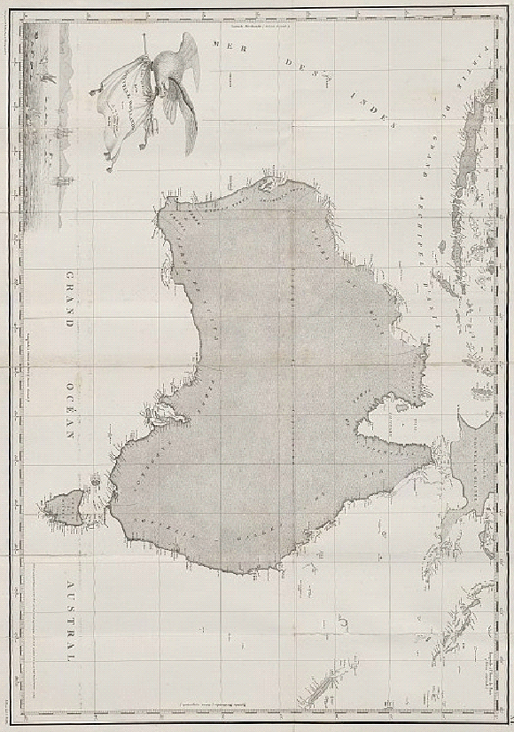
The French expeditions from Bougainville onwards resulted in major published compilations exhibiting the work and methods of influential cartographic figures in the office of the Depôt des Cartes et Plans. The display provided several of the key works as a backdrop to some original materials, and demonstrated advances in coastal surveying methods made by Charles-François Beautemps-Beaupré and others. The published atlases included Beautemps-Beaupré’s Atlas du voyage de Bruny-D’éntrecasteaux… 1791, 1792 et 1793, published in Paris 1807 as the official cartographic account of the D’Entrecasteaux voyage in search of La Perouse. The volume contains 39 charts, of which those for Van Diemen’s Land are the most detailed.
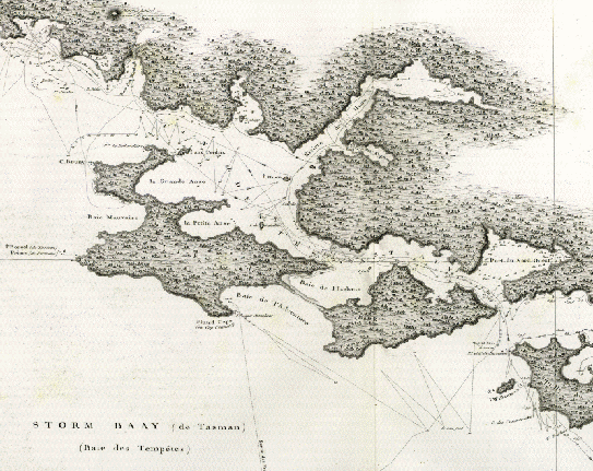
Chart detail, “Canal Dentrecasteaux”, Atlas du voyage de Bruny-Dentrecasteaux
[MAP Ra 82, plate 4]
The National Library has digitised all plates from this atlas: http://nla.gov.au/nla.map-ra82
The Library has several editions of charts executed by the brothers Louis Claude and Louis Henri Desaulses de Freycinet during the Baudin expedition, among them the enlarged edition of Voyage de decouvertes aux terres australes…, published Paris 1812. Atlas volume digitised: http://nla.gov.au/nla.map-raa2
The atlas published in 1826 under Louis Claude’s supervision, of his voyage in command of the corvette Uranie, provided a counterpoint to the recent acquisition from the Woodside Foundation in Western Australia, of several items including a letter from Rose de Freycinet to her sister-in-law, Clementine, wife of Henri, 20 November 1824, and an earlier letter from Louis-Claude to his brother, Henri, 30 October 1806. These were displayed along with a selection of recently acquired letters with a focus on the natural history part of the endeavour, including an official letter in December 1816 to Louis de Freycinet signed by the scientists Vauquelin, Desfontaines and Jussieu, professors of the Museum d’Histoire Naturelle, Paris. The letter states their support for the collection of natural history specimens on the Uranie voyage and the appointment of a naturalist for this purpose. A further letter of 1825 from Francois Arago written on behalf of the Academie des Sciences to Louis de Freycinet reports on a decision made to deposit the material collected on the Uranie expedition at the Academie under the care of M. Cardot for the perusal of the various specialists working on the long-overdue report on the expedition. It is addressed to the house of Mme. Pinon, the mother of Freycinet’s wife Rose.
There were in addition two watercolours, depicting the reception of the expedition at Dili, Timor. While the official version of the scene in the narrative of the voyage depicts a formal occasion and where Rose is absent from the scene, the painting by L’Uranie artist Jacques Arago is more faithful to that described in Rose’s journal.
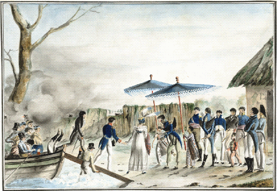
“Reception a Diely, Timor, 1818”, Jacques Arago
[PIC/14477 LOC 6031]
The drawing has been digitised: http://nla.gov.au/nla.pic-vn5016825
Original cartographic items in Australian libraries from the French voyages are rare, and the opportunity to display three during the symposium was exceptional. A chart annotated by Louis de Freycinet directly following the Baudin expedition, completes the coastline left blank by Beautemps-Beaupré in his “Carte reduite de la Nouvelle Hollande et des archipels”. The amended chart was produced prior to publication of the voyage accounts, with part of the missing South Australian coastline sketched in pencil, the course of the Swan River marked, the correct form of Cape Leeuwin drawn in and with historical annotations of earlier Dutch voyages along the north-west Australian coast.
Two Arrowsmith published charts with annotations by Freycinet explain the loss of the Uranie at the Falkland Islands. “Chart of the southern promontory of America from the Spanish survey made in the years 1789, 1790, 1794 and 1795” published 1802, is Freycinet’s overview chart for the final leg of the Uranie’s return voyage. Though the latest chart available to Freycinet, numerous annotations follow the course of the Uranie to its resting place at Isle Soledad and French Bay (Berkeley Sound), the site of the corvette’s final stranding. Of particular interest is Freycinet’s detailed track of the vessel and numerous annotations all in pencil in his distinctive hand. The chart track shows the sailing of the Uranie before the wreck, while some of the exasperated notes – “incorrect”, “à n’y rien connaître”, etc, underline Freycinet’s frustration with the inaccuracies in the charting of these difficult waters.
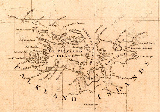
Chart detail, “Chart of the southern promontory of America from the Spanish survey…”
[MAP RM 4473]
Chart digitised: http://nla.gov.au/nla.map-rm4473
All the items were magnificently conserved and presented. Given the limitations of space in the Maps Room and the time required to view the maps, atlases and other works, over 100 guests viewed the display in small groups, providing close access to the materials, with the assistance of Library staff.
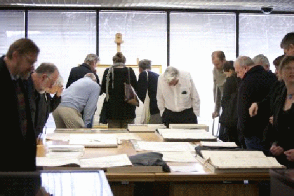
Viewing the Exhibition
(Photo: Sam Cooper – National Library of Australia)